Drawing Maps!

(map data copyright 2023 Google, traced from two Google Maps screenshots)
So. Here’s our playground. You’re going to want to familiarize yourself with basic European geography. This is just good knowledge to have, even outside the classroom.
Let’s try drawing a more simplified version of this for your notes!
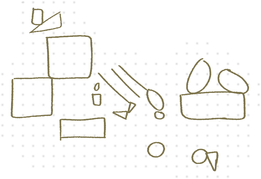
- Draw 3 parallel lines at an angle for Italy and the Adriatic, then a couple of triangles to do the “toe” and Sicily. Next to that, do a couple little shapes for Corsica and Sardinia.
- To the right of that, draw two ovals. That’ll be Greece. Below that, draw a circle. That’ll be part of the northern coast of Libya.
- Go a bit further to the right and draw a big rectangle with two ovals on top. These will be Turkey and the Black Sea. Below that, draw a circle and a triangle right next to each other. Those will be the Nile Delta and the Sinai Peninsula of Egypt.
- Now, over to the left, draw two big squares which meet at the corner. Those will become France and the Iberian Peninsula.
- Below that, draw a rectangle. That’ll become the northern part of Algeria and Tunisia.
- Finally, above those two, draw a wide triangle and a rectangle. That’ll become the southern part of Great Britain.
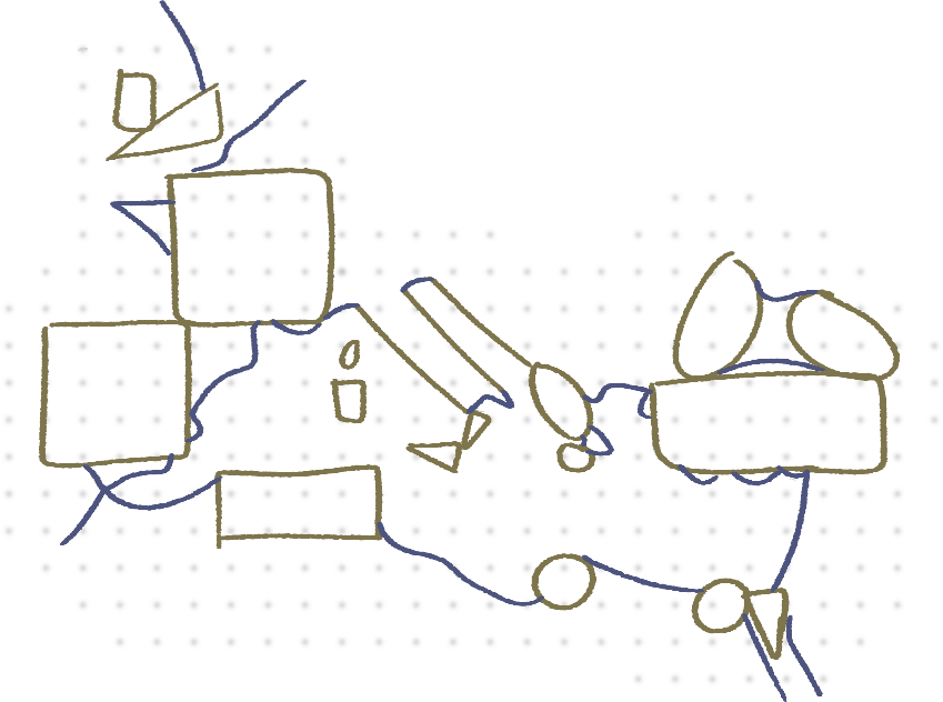
- Next, we’ll connect these shapes together with some blobby lines. It’s okay to trail off in the north and the south, the Romans didn’t make it that far.
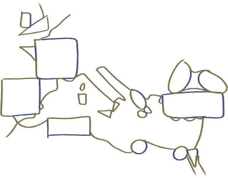
- Finally, we can get rid of the bits we don’t need. I’ve marked those in blue here. You can erase them. Or if you’re feeling fancy, you can trace the yellow bits with a pen, wait for it to dry, and erase the pencil underneath.

Ecce! We’ve drawn a map of Europe and North Africa! Wasn’t that easy? Now you can use this for your notes without having to print one out.